Archimedes may have shouted out this when discovering that
his body mass in his bath caused the water level to increase, a piece of
mathematical genius called displacement theory used ever since in a variety of
ways but it is difficult to understand why General Vallejo, one of the architects
of modern day California, should have chosen Eureka for his state capital
located as it is so far to the north of the state.
It may have been that at that time it was a highly busy
fishing and logging port with the largest number of Victorian homes outside New
England (if you believe the California guidebook). However today it is almost wholly dependent
on tourism for its survival as like much of northern California the fishing and
logging industries died long ago.
 |
| Often foggy in the morning… |
 |
| … it soon cleared up |
We had chosen it as our base in the far north largely due to its proximity to the even further north Redwood National Park, a place Viv and I wanted to visit. The drive there up the Pacific Coast Highway, Route 1, to Leggett where the road joined up with 101 was nothing short of spectacular, particularly the change from rugged coastline north of Fort Bragg to winding switchback roads through thick forests that Viv behind the wheel handled most adeptly. The last 30 miles in particular were very, very windy indeed!
At Leggett we found the ‘World Famous Drive Thru Tree’ –
sorry about the spelling! – a 2400 year old Redwood called the Chandelier Tree
(see website here) standing 315 feet high which years ago had been hollowed out
so that cars could drive thru, I mean through, it. One of the national park publications I
picked up charmingly explained that:
“Carving through a
hole through a coastal redwood reflects a time passed when we didn’t fully
appreciate the significance of all organisms and their interplay with the
environment.”

I don’t disagree that in the past that we’d overdone the
exploitation of the environment but really there’s no need to be so preachy
about it all the time nor to deny the simple enjoyment of driving through this
tree, silly as it sounds (three times in our case!). The place was packed by the way.
We skirted the Avenue of the Giants, another long stretch of
scenic road we planned to drive through on our return (see website here) and
soon enough ended up in Eureka where we’d booked a hotel ‘downtown’. In retrospect this was a mistake as although
the guidebooks refer to a ‘vibrant Old Town’, on that Saturday night when we
searched for it, it was closed or at least seemed to be.
However that afternoon we decided to take a look around the
sand bar that protected the bay from the ocean and was the reason why the
logging companies made Eureka their go to port in this part of the country in
the old days. Nowadays it houses the
Coast Guard, Samoa Dunes National Park and the Samoa Cookhouse.
I have mentioned that our progress in California so far had
been marked by epicurean behavior in spades so the prospect of dining at one of
the few remaining cookhouses in California proved an irresistible prospect for
us!
First though we went for a long hike along the dunes and
jetty that comprised the national park.
Dating back to the mid-1800’s, a local lady we met with her dogs told us
that this was one of the most dangerous ports on the coast and certainly the
patch of water between the two jetties heading out into the ocean (not piers
and definitely not in the class of Southend’s longest pier in the world!) was
very choppy indeed. We spotted some
dolphins heading in towards the harbor which was very exciting.

The river that fed the estuary that created the harbor was a
main point for ferrying logs down from the interior (no railway like at Fort
Bragg). In the past, the final mile or
so to the waiting logging schooners moored offshore in the tumultuous waves was
served by a gravity fed ‘railway’.
Loggers put the logs onto the trucks which free wheeled down to the
boats with the trucks being hauled back up to the start point again by horses. Not much of this now remains.
This lady was a fund of local information too but most
dismissive of the local marijuana growers – ‘marijuana millionaires’ she called
them. This is big business up here too
along with the tourist industry and keeps mainly the young men in
employment. The problem appears endemic
now.
 |
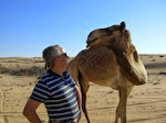
| A furry friend |
The Cookhouse was a real blast from the past. All you can eat portions of one dish served
family style for $15.95. That night’s
menu was baked ham and fried chicken with all the fixin’s you can imagine!

 |
| Nuthin' Fancy |
However that wasn’t why we were there. We’d stopped at the national park office and a ranger had advised a couple of scenic drives and walks up and down the park. First was in the very far north in the part of the park called the Jedediah Smith Redwoods State Park.
 |
| The start of the Redwood National Forest |
Jedediah (great name incidentally) had arrived in California from his native Kentucky with the first group of overland settlers from the east fired by the notion of vast swathes of new fertile land to the far west. He was a ‘frontiersman’ – i.e. good with a rifle and able to live off the land – and liked it so much he stayed. That portion of the park is 10 miles away from Crescent City -- the farthest north town in California and one of only two towns, the other being Monterey, susceptible to tsunami’s. We’d found this out from the people we’d met in Fort Bragg who told us that the tsunami that hammered Japan a few years back also wiped out Crescent City. We drove back through that city incidentally and it really is flat as a pancake… as well as being pretty small. Most of the buildings are on the highway these days.
 |
| Tsunami survivor in Crescent City |
What a drive it was!
All on unpaved roads with monster first growth redwoods on both sides of
the track. Wow!! We stopped at the shorter Stout Grove Trail
to get our tree hug for the day and spent an age just sitting there taking it
all in. Spectacular isn’t the word for
it. I cannot think what is.

The next event was the 15 mile long Newton B Dury Scenic
Parkway (see website here) running south of Klamath to Elk Prairie, both tiny
townships, which was again full of lovely old redwoods but also Roosevelt Elk,
the local large critter. We found loads
of them sitting off just grazing peacefully completely oblivious to strange
humans snapping away only a few yards away.
Again the herds were split by gender
-- far more females than males.

The final trail of the day was the Lady Bird Johnson Grove
Trail just outside a township called Orick, further south. We drove 3 miles off the highway to the 1.5
mile trail where we were advised to speak loudly as there were plenty of bears
and mountain lions all around.

Despite this threat of immediate evisceration, Viv and I spent another long period of time with these marvelous, monster trees (yes, more hugging too!) feeling quite a connection by the end (even me).
Despite this threat of immediate evisceration, Viv and I spent another long period of time with these marvelous, monster trees (yes, more hugging too!) feeling quite a connection by the end (even me).
LBJ’s missus had a keen environmental interest and persuaded
her hubby and then his VP, Richard Nixon, as well as then California Governor,
Ronald Reagan, to dedicate some land to redwood preservation and this happened
in 1969 with more acreage being added occasionally thereafter. Great idea!

We’d been advised that the small town of Trinidad (named by
Spanish sailors who landed on the coast on Trinity Sunday 300 years ago) was
both cute and had some nice restaurants so we stopped at Larryman’s Restaurant
for dinner. Our friendly lady on Samoa
Dunes had told us this was a nice but expensive place and curiously we found it
appeared to be full of those folks she was so disapproving of.
They could of course have been Silicon Valley millionaires
up for the weekend!
What a day though.